
Nordic Volcanological Center, Institute of Earth Sciences, University of Iceland
Venue: Kríunes, Kópavogur, Iceland, 17-24 August 2013
The Summer School is primarily intended for PhD students. It will address the wide geological applications of remote sensing data and focus on application of remote sensing techniques in a dynamic geological setting. When geological features change, either abruptly (e.g. during volcanic eruptions, landslides or flooding), or slowly (e.g. changes in landscape or glacial extent) a need for remapping arises. Remote sensing techniques allow time efficient mapping on a big spatial scale. The large amounts of available data from various satellite sensors, as well as the increasing spatial resolution, call for a need to automate the mapping and bridge the fields of geology and computer engineering. Several state-of-the-art approaches to semi-automated mapping will be demonstrated at the Summer School, including both supervised and unsupervised techniques. Furthermore, colleagues from the planetary sciences will be brought in, as these are true experts on the forefront of remote sensing, in the case where obtaining ground truth is not an option.
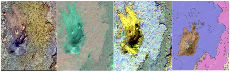
Location: Iceland may be considered a natural laboratory for many types of dynamic geological processes and provides unique opportunities for excellent field demonstrations of a wide selection of remote sensing data applications. Though volcanic activity is almost unique to Iceland on a Nordic scale, Iceland also provides many opportunities to study geological events common with other Nordic countries, such as land- and mudslides, glacial changes and effects of flooding events. The barren land makes it an ideal target for practising geological mapping of surface features, and it is the Nordic country exposed to the largest variety of natural hazards, where rapid remapping of surface features through remote sensing data, may provide decision makers with important information in a crisis situation.
Set up: The school will be divided into four main sessions, where lectures, fieldwork and practical sessions will focus on specific topics (see programme overview below). Three field days aim to tie together the theoretical and practical sessions presented, highlighting the practical use of remote sensing data in a dynamic geological environment.
Registration and fees: Deadline for application is June 15th, 2013. An abstract is required to accompany all applications, as the participants are requested to present their own work on a poster at the Summer School. There is a maximum of 20 students admitted to the course, with a number of places reserved for Nordic participants. All participants are required to pay a registration fee of 200 EUR (non refundable), which covers tuition, course materials and transport during field trips. Furthermore, all participants must cover their own travel to and from Iceland, as well as accommodation in Iceland after the school (if required). For Nordic participants the cost of hotel accommodation and meals during the school is all covered by a NordForsk grant. Students from other countries need to cover the cost of 900 EUR for hotel accommodation and meals at the venue.
Organisers:
Rikke Pedersen, Gro B. M. Pedersen and Ingibjörg Jónsdóttir,
Nordic Volcanological Center, University of Iceland, Reykjavík, Iceland
Confirmed Lecturers:
Baard Romstad, CICERO, Norway,
Erik Vest Sørensen, GEUS, Denmark,
Petri Pellikka, UH, Finland
Simone Tarquini, INGV, Italy,
Rosaly Lopes, JPL, USA,
Scott M. White, USC, USA,
Maarit Middleton, GTK, Finland,
Þröstur Þorsteinsson, UI, Iceland
Gro B. M. Pedersen, UI, Iceland
Ingibjörg Jónsdóttir, UI, Iceland
Programme Overview:
August 17: All participants meet at the Reykjavík Bus terminal (BSÍ). Transfer to the school location for dinner and short introductory lectures.
August 18: Topic 1: Real-time monitoring by remote sensing techniques. Lectures, practical session and posters.
August 19: Field trip to the Eyjafjallajökull area, the site of the 2010 air-traffic disrupting eruptions, where remote sensing data assisted scientists in decision making during the natural hazard events.
August 20: Topic 2: Geological mapping; Manual and pixel-based classification. Lectures, practical session and posters.
August 21: Field trip to the Reykjanes peninsula visiting areas which were mapped during the practical session, providing the students with practical experience on obtaining ground truth for their remote sensing mapping efforts.
August 22: Topic 3: Automated mapping techniques. Lectures and posters.
August 23: Topic 4: Remote sensing beyond Earth's surface. Lectures and posters.
August 24: Field trip to Þingvellir and Hekla, demonstrating areas where applications of automated mapping techniques would be of great benefit. Return to Reykjavik in the evening. Closing of the school.